Level of detail
Jan Marsch • 2018-02-28
Time to write about level of detail.
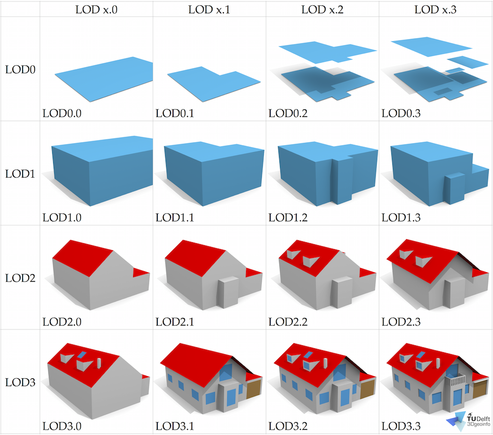
This is image is taken from friendly people at TU Delft who have deep knowledge about city models and geometry processing.
There are various classifications and none is the only truth.
But this one would be closest to our understanding.

LOD 0
This is just a building footprint. No height attached, no building parts visible. Vast majority of buildings in OpenStreetMap and open data city models are just that: flat polygons.
Our viewers are interpolating this situation as follows: if no height is present, look for levels. If nothing is present, assume 3 levels as default. Every level is rendered 3 meters high. If you are using our data for scientific reasons: we are not touching source data.
LOD 1
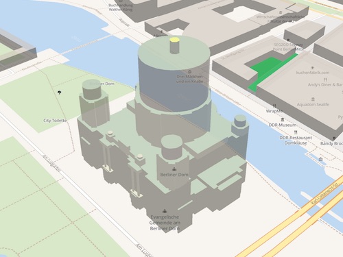
Like LOD 0 but with height or levels information attached. Variants may contain building parts of different height. Note: this is the maximum quality that Mapbox GL can handle.

LOD 2
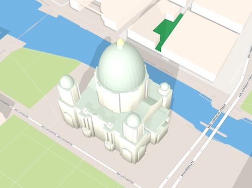
Roof shapes are most significant improvement here. For OSM Buildings there are 2 flavors: OpenStreetMap with footprint polygon, height value und roof shape as literal tag. This is what our viewers turn into pyramids, domes and gabled, skillion roofs for most recent version. The other variant is a fully triangulated 3d object that could have any shape. Our latest viewer supports this as well.

LOD 3
This covers more roof details as well as facade details. There is no efficient way to handle this in OpenStreetMap but custom 3d objects can still be displayed in our viewers.
What do you think? Let us know
